The Agricultural Drought Monitoring System (ADMS) is designed to identify areas where there are crop losses caused by drought conditions, which are listed in the "Act on subsidies to insurance of agricultural crops and farm animals".
In the ADMS, meteorological conditions that are causing drought are evaluated by the climatic water balance (CWB). CWB expresses the difference between the precipitation and potential evapotranspiration.
Were:
CWB - Climatic Water Balance
P - precipitation in given period
ETP - Penman ewapotranspiration in given period
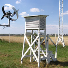
The meteorological stations measure the precipitation while the value of potential evapotranspiration (expressed as an approximately capacity of the evaporation of the water from living short grass is calculated using the Penman method. This value with a high precision can also be evaluated by the use of simplified models, which include meteorological elements that are normally measured by the meteorological stations in Poland.
In order to classify an agricultural drought, the entire complex of weather and soil conditions is taken into consideration.
According to the definition specified in the Act, drought is defined by damage caused by the occurrence of a climatic water balance (CWB) below a defined value for an individual species or groups of cultivated plants as well as the soil category in any (60 day) period from 21 March to 30 September of that year.
For example, the occurrence of a climatic water balance below 140 mm during the period from 1 April to 31 May, means that the drought threat affected winter and spring cereals on soils that are classified as category I (very light soil). Periods of sixty-days from 1 April to 30 September are calculated in the following manner.
The appearance of a specified value of CWB shown in an Annex to the Act, causes on average a 20% reduction in the yield, this relates to the value of the long-term average. Critical values of the climatic water balance; means the appearance of the drought was changeable for plant species or groups of cultivation plants and soil categories and periods of development.
To designate the level of climatic water balance, statistic-empirical models of forecasts and simulation model for crop yields, developed at the Institute of Soil Science and Crop Cultivation - State Research Institute in Puławy were used.
In determining the areas affected by the drought, besides the value of climatic water balance, the characteristics of the soil retention are determined by Soil category, and are identified based on soil and agricultural maps. In this way, a strong diversification of the susceptibility of Polish soil cover to the effects of a shortage of water is taken into account.
In 2008, the ADMS used data from 55 Synoptic stations and about 220 rainwater stations that belongs the Institute of Meteorology and Water Management (IMWM).
ADMS includes computer applications that are integrating meteorological data needed to calculate the climatic water balance along with data from soil-agricultural digital maps illustrating the spatial diversity of the various categories of water retention of agronomic soils. Information regarding the appearance of the drought in the form of sixty-day reports are forwarded to the Ministry of Agriculture and Rural Development and is then published on the website.


